Search results for keyword: sensing
underground pipeline detection
Underground pipeline detection
With the rapid development of global industry, pipelines have become an important mode of transportation for oil, gas and water. Therefore, the reliable operation of pipelines has become increasingly important. To ensure normal operation and safety, regular maintena......

 1041
1041  Sophia
Engineering Survey and Measuring Instruments
Engineering Surveying Instruments
Engineering surveying instruments are an essential element of engineering surveying, providing the accuracy and reliability needed to perform surveying tasks accurately. Engineering surveying instruments are used to measure distances and angles, and also to measu......
China Metallurgical Geological Exploration
1 Introduction
Metallurgy and geology are two of the most important branches of science. Chinese metallurgy dates back over 4,000 years, when it was discovered that certain metals could be used to make tools and weapons. In modern times, the geology of China has made it an important source of va......
Saline Soil Foundation Survey
Salt Marsh Exploration
Salt marshes are unique environments that have a variety of features that must be explored and understood in order to effectively manage them. A salt marsh has many landforms, vegetation and aquatic communities that are vital for the health of the local ecosystem. Therefore......
Karst area survey
Karst landscapes are geographically widespread and are developed predominantly on a variety of carbonate rocks, although areas of limestones, gypsum and hydrogenic rocks are also affected in certain regions. The term ‘karst’ is derived from the Karst topography of the limestone region of Sloveni......
Remote sensing Technology
Introduction
Remote sensing technology refers to the process of gathering information about an object or area from a distance. The data gathered can be used for many purposes, including mapping, monitoring, assessing, and managing the environment. This technology has become increasingly important......
Terrestrial photogrammetry
Aerial photogrammetric surveying is a form of surveying that makes use of aerial photography and photogrammetric technology to map a given area of land. It is often used in the fields of engineering, topography, forestry, and cartography.
Aerial photogrammetric surveying works by taking multiple......
Engineering geological surveying and mapping
Engineering and Geological Surveying
Engineering and geological surveying, or more formally known as geotechnical surveying, is an important component of the geospatial science of surveying and mapping. It is the integration of three disciplines: civil engineering, geology and surveying. The goal......
Groundwater dynamic monitoring
Underground Water Dynamic Monitoring
Underground water is one of the most critical resources in many parts of the world. It is an important source of drinking water and it is necessary for the sustainability of many ecosystems, as well as for agricultural production. To properly manage undergroun......
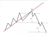
Ground pressure of longwall working face
Large long wall base of pressure
Long wall mining has become most common method of underground coal mining, because it improves the productivity, reduces production costs and provides a safe working environment for all miners. Long wall mining is a type of underground coal mining in which a part of......


Popular Entries
- Spanish heat-resistant steel steel grade
- Faults caused by incorrect mixing ratio of gasoline and engine oil
- How lifts work
- overseas trade
- London Exchange Alternative Investment Market
- Zibo Fushan Mining Co., Ltd.
- Brinell/Rockwell hardness conversion table
- Zhangjiagang Rural Commercial Bank
- ГOCT 5949-1975 Specifications for corrosion-resistant, heat-resistant and heat-strength steel bars and cold-worked products
- thermodynamics thermodynamics
- re-election workshop design
- employee satisfaction
- Density of diamond
- Rationalized Global Planning Model
- digital wallet
Recent Updates
- continuous casting
- ГOCT 5949-1975 Specifications for corrosion-resistant, heat-resistant and heat-strength steel bars and cold-worked products
- overseas trade
- shipping
- Korea Xinsheng Shipping Co., Ltd. Shanghai Office
- Hamilton's Protectionist Trade Doctrine
- Rationalized Global Planning Model
- Heckscher-Ohlin model
- black market price
- buy each other
- principle of reciprocal treatment
- The unit that accepts entrusted customs declaration
- reciprocal tariff
- sliding tariff
- digital wallet
- horizontal trade
Trending Keywords

Copyright © 2016 - 2024 by metal-knowledge.com. All rights reserved